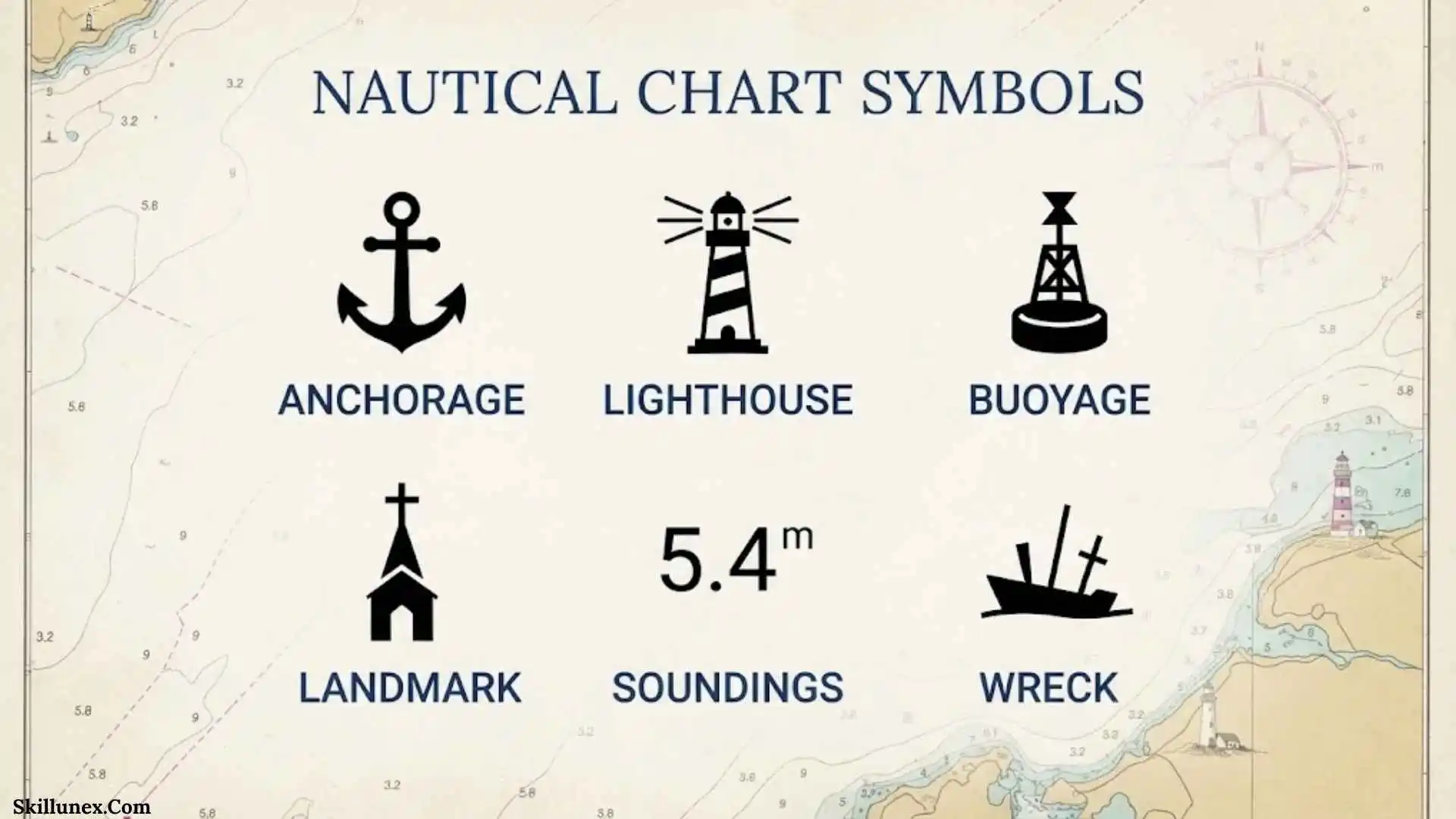
Nautical chart symbols are the visual language of marine navigation. They show important information about water depth, buoys, lights, channels, rocks, wrecks, obstructions, anchorages, cables, pipelines, shore features, and other conditions that can affect navigation. Once you understand what these symbols mean, a chart that initially looks complicated becomes much easier to read.
If you are learning marine navigation, preparing for a boating trip, studying nautical charts, or simply trying to understand what the markings on a marine chart mean, learning the major symbol categories is a useful starting point. Official references such as NOAA’s U.S. Chart No. 1 and the International Hydrographic Organization’s INT 1 provide standardized references for many nautical chart symbols and abbreviations.
What Are Nautical Chart Symbols?
Nautical chart symbols are standardized marks, abbreviations, numbers, lines, colors, and other graphic elements used to communicate information on a marine chart. Instead of writing a complete description for every feature, chartmakers use compact symbols that allow a large amount of navigation information to fit into a relatively small area.
These symbols can represent both natural and man-made features. Natural features include rocks, reefs, shoals, sandbanks, seabed characteristics, and changes in water depth. Man-made or navigational features can include buoys, beacons, lighthouses, wrecks, cables, pipelines, piers, bridges, and restricted areas.
For U.S. nautical charts, U.S. Chart No. 1 is an important reference. NOAA explains that it describes the symbols, abbreviations, and terms used on NOAA and National Geospatial-Intelligence Agency nautical charts and also includes symbols used to portray NOAA electronic navigational chart data on ECDIS.
Why Are Nautical Chart Symbols Important?
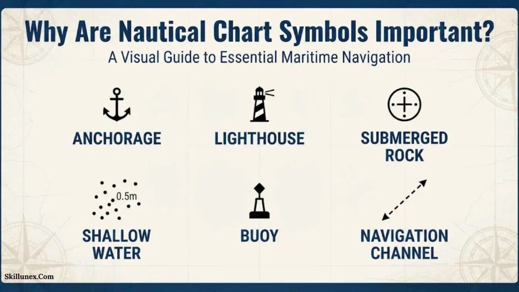
A nautical chart contains much more information than a simple map of the coastline. A navigator needs to know not only where land is located but also what lies beneath the water, where navigation hazards exist, which aids mark a channel, and whether special restrictions apply in a particular area.
Understanding chart symbols helps you identify:
- Water depths and changes in depth
- Shallow areas and shoals
- Rocks and reefs
- Wrecks and obstructions
- Buoys and beacons
- Lighthouses and other lights
- Channels and fairways
- Anchorages
- Restricted and regulated areas
- Underwater cables and pipelines
- Bridges, piers, and other structures
- Seabed or bottom characteristics
- Compass and navigation information
- Chart notes and abbreviations
NOAA points out that nautical charts contain a large amount of information, including lights, buoys, wrecks, sea-bottom information, shoreline features, and water depths. Because these features can occur close together, symbols and abbreviations are essential for keeping charts readable.
Main Types Of Nautical Chart Symbols
Nautical chart symbols can be easier to learn when they are divided into logical groups. Each group answers a different navigation question.
Depth And Sounding Symbols
Depth information is among the most important information on a nautical chart. Soundings show the charted depth at specific locations and allow navigators to understand how much water is available in an area.
A sounding may appear as a number positioned in the water area of a chart. Before interpreting the number, check the chart’s stated units and vertical datum. The same numerical value can have a different practical meaning depending on the units and reference level used by the chart.
Depth information can help you identify:
- Deep-water areas
- Shallow water
- Changes in seabed elevation
- Potential grounding hazards
- Navigable channels
- Areas requiring greater caution
A single sounding should not normally be interpreted by itself. Compare nearby soundings, depth contours, hazards, tidal information, and other chart details when assessing an area.
Depth Contours
Depth contours are lines used to connect locations with similar charted depths. They provide a visual picture of the underwater shape of the seabed.
When contours are close together, depth may be changing relatively quickly across a short horizontal distance. When contours are farther apart, the change may be more gradual.
Depth contours are particularly useful when you want to understand the general underwater terrain rather than looking at individual sounding numbers.
Buoy Symbols
Buoys are floating aids to navigation that help mariners identify channels, hazards, turning points, safe-water areas, and other navigational information.
A nautical chart may show a buoy using a standardized symbol together with information such as its identification, light characteristics, or other attributes.
Buoyage systems are based on international standards, but the applicable buoyage region matters. NOAA’s U.S. Chart No. 1 includes information about the IALA Maritime Buoyage System used in the United States and other seafaring nations.
Lateral Marks
Lateral marks help identify the sides of navigable channels. Their meaning depends on the applicable buoyage system and direction of buoyage.
In U.S. waters, the IALA-B system is used in the 50 states and the Caribbean, while IALA-A is used in U.S. territories in the South Pacific. NOAA specifically notes that the top marks of certain aids differ between these systems.
Because buoyage systems can vary by region, never assume that the same color or shape has exactly the same meaning everywhere. Check the chart and the applicable buoyage system.
Safe Water Marks
Safe water marks indicate navigable water around the mark and can be associated with the centerline of a channel, a landfall, or other situations where the mariner needs an indication of generally safe water.
Their chart symbol and physical appearance are defined through the applicable navigation-aid system. The chart legend and buoyage reference should be used when interpreting them.
Special Marks
Special marks identify particular areas or features rather than simply marking the left or right side of a channel. They can be associated with areas such as special-use zones, traffic arrangements, or other designated features.
The exact purpose of a special mark should be determined from the chart information rather than guessed from its color alone.
Lights And Light Characteristics On Nautical Charts
Lights are important aids to navigation, especially when operating at night or in reduced visibility.
A chart can provide information about a light’s location and characteristics. Light characteristics may describe how the light appears over time, including its color and flashing pattern.
Different light characteristics can help mariners distinguish one navigation aid from another. However, reading a light correctly requires more than recognizing a lighthouse symbol. The accompanying light description is also important.
When interpreting a charted light, pay attention to:
- Light color
- Flashing characteristics
- Period
- Elevation where provided
- Nominal range where provided
- Structure or location
- Additional chart notes
Beacon And Lighthouse Symbols
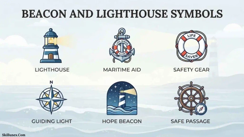
A beacon is a fixed aid to navigation, while a lighthouse is a prominent structure that can carry a navigation light.
Charts use symbols to identify these fixed navigation aids and may provide additional information about their characteristics.
A lighthouse can be especially useful as a visual landmark, while smaller beacons may help define channels, hazards, or specific navigational positions.
Wreck Symbols On Nautical Charts
Wreck symbols identify charted remains of vessels or other wreck-related features.
A wreck can be significant to navigation when it creates an obstruction, especially in relatively shallow water or near a commonly used route. The chart may provide information about the wreck’s position and, where known, its least depth.
Not every wreck presents the same level of navigational danger. Its charted depth, surrounding water, position, and other information must be considered together.
Rock And Reef Symbols
Rocks, reefs, coral formations, and similar features can create significant navigation hazards.
A chart may distinguish between features that remain above water, those that are submerged, and those that may become exposed or uncovered depending on the water level.
This distinction matters because a feature that appears close to the waterline can have very different implications from one that remains permanently submerged.
Submerged Rocks
A submerged rock is below the water surface but may still create a navigation hazard. Its charted position and depth should be considered carefully when planning a route nearby.
Drying Features
Some charted features can be uncovered at low water and covered at higher water levels. Their chart representation needs to be interpreted with the chart’s vertical datum and tidal information.
Shoals And Shallow Water Symbols
A shoal is an area where water is relatively shallow compared with the surrounding area.
Shoals can occur naturally through sand, sediment, rock, coral, or other seabed features. Charts use soundings, contours, and symbols to help identify these areas.
When approaching a shoal, look beyond a single symbol. Examine the surrounding depth information and consider the vessel’s draft, available under-keel clearance, tide, and other relevant conditions.
Obstruction Symbols
An obstruction symbol identifies a feature that may present a danger or limitation to navigation.
Obstructions can include submerged structures, objects, or other features that are not necessarily represented as ordinary land or seabed features.
The charted information may provide additional details about the obstruction. Because the nature and depth of an obstruction can vary, the surrounding notes and soundings should be checked carefully.
Fish Haven Symbols
Fish havens are charted areas created or designated to provide habitat for fish or other marine life. NOAA has specifically published guidance about fish haven symbology because these symbols can be confusing when encountered in context with other charted features.
A fish haven should not simply be treated as an ordinary open-water area. Check the chart for its specific designation and any applicable restrictions or navigation information.
Anchorage Symbols
Anchorage symbols indicate areas associated with anchoring.
However, an anchor symbol on a chart does not automatically mean that a vessel can anchor anywhere around that symbol. NOAA specifically notes that the meaning of the anchorage symbol has evolved and that understanding what the symbol does and does not mean is important.
Before anchoring, check:
- Local regulations
- Chart notes
- Depth
- Seabed characteristics
- Nearby hazards
- Traffic
- Weather and wind
- Tidal conditions
- Vessel requirements
Restricted And Regulated Area Symbols
Nautical charts can show areas where navigation or particular activities are restricted or regulated.
These areas may be associated with:
- Military activities
- Environmental protection
- Construction
- Traffic control
- Safety zones
- Special-use activities
- Other legal restrictions
The chart symbol provides an important warning, but the exact legal requirements may require additional official information. Do not assume that the visual boundary alone explains every restriction.
Cable And Pipeline Symbols
Underwater cables and pipelines are represented using specialized chart symbols and lines.
These features are important because certain activities, including anchoring or fishing, may be restricted in their vicinity. Their presence can also be relevant when planning a route or operating equipment near the seabed.
Always check the chart notes and applicable local regulations before conducting activities around charted cables or pipelines.
Seabed And Bottom Symbols
Nautical charts can provide information about the material or characteristics of the seabed.
Common descriptions may include:
- Sand
- Mud
- Gravel
- Rock
- Shells
- Coral
- Mixed bottom materials
Seabed information can be particularly useful when evaluating anchoring locations and understanding underwater terrain. It should still be considered alongside depth, weather, currents, tides, and local conditions.
Shoreline And Coastal Feature Symbols
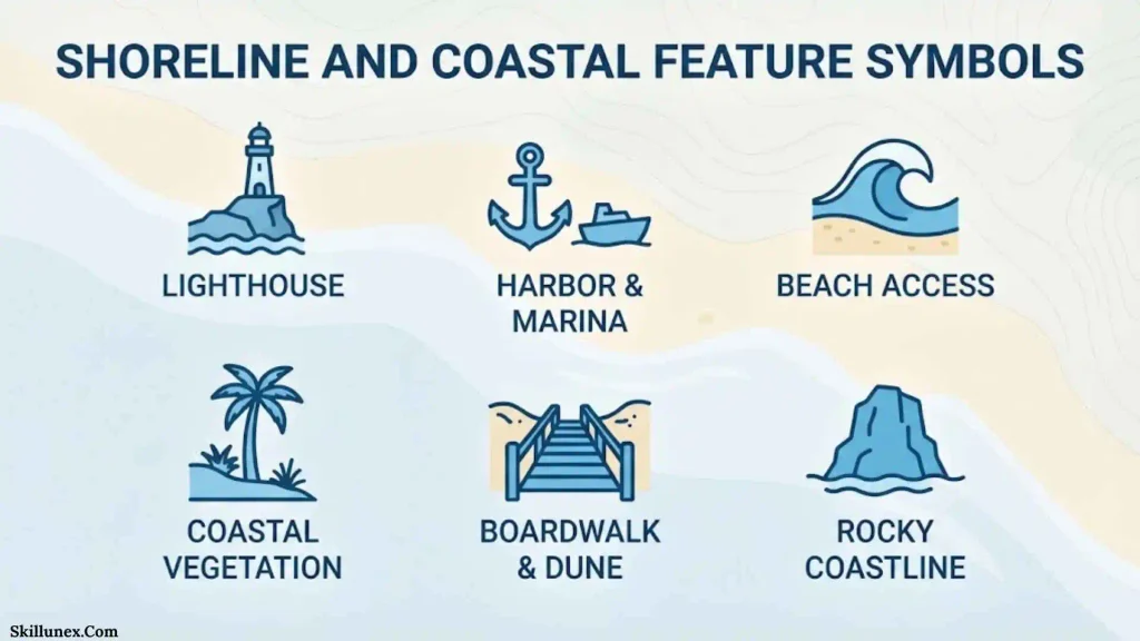
Nautical charts also contain symbols for features located on or near land.
These can include:
- Coastlines
- Cliffs
- Sand beaches
- Dunes
- Piers
- Jetties
- Breakwaters
- Bridges
- Towers
- Buildings
- Tanks
- Prominent landmarks
These features can help mariners identify their position visually and understand the physical environment around a harbor, coast, or waterway.
Compass Rose And Direction Information
A compass rose is used to help determine direction and bearings on a nautical chart.
NOAA explains that the compass rose simplifies measuring directions and that geographic north, or true north, is an important reference direction on nautical charts.
A compass rose can also help distinguish between different directional references. When taking bearings or plotting a course, make sure you understand which reference is being used and account for relevant compass information.
Nautical Chart Colors And What They Show
Colors are an important part of chart interpretation, but they should not be learned as a universal shortcut.
Different colors may be used to distinguish:
- Land
- Water
- Shallow areas
- Intertidal areas
- Navigation aids
- Special areas
- Depth-related information
- Other chart features
The exact color conventions can depend on the chart product and publication standards. The chart’s own legend should therefore be treated as the final reference.
The IHO maintains international standards and publications related to chart specifications, symbols, abbreviations, and chart colors. Its current standards page lists S-4 and the associated INT publications, including INT 1 for symbols and abbreviations used on paper charts.
Nautical Chart Abbreviations
Nautical charts use abbreviations because there is limited space available for written descriptions.
Abbreviations may describe:
- Seabed materials
- Lights
- Buoys
- Wrecks
- Rocks
- Structures
- Navigation features
- Geographic features
- Depth information
For example, a navigator may encounter short forms for bottom materials or light characteristics that are not immediately obvious to someone unfamiliar with chart terminology.
When an abbreviation is unfamiliar, consult the appropriate official chart reference rather than guessing its meaning.
How To Read Nautical Chart Symbols Step By Step
Reading a nautical chart becomes much easier when you follow a systematic process.
Step 1: Check The Chart Information
Start by checking the chart title, scale, publication information, units, datum, and other notes.
These details establish how the information on the chart should be interpreted.
Step 2: Find The Legend
Locate the chart legend or use an official symbol reference. If you are using a U.S. chart, U.S. Chart No. 1 is a major reference for symbols, abbreviations, and terms.
Step 3: Check Water Depth
Study soundings and depth contours before considering a route.
Look for areas where depth changes quickly, shallow areas, shoals, and other underwater hazards.
Step 4: Identify Navigation Aids
Locate buoys, beacons, lights, and other aids that help define channels and hazards.
Step 5: Look For Hazards
Search the area for:
- Wrecks
- Rocks
- Reefs
- Obstructions
- Shoals
- Cables
- Pipelines
- Other marked dangers
Step 6: Check Special Areas
Look for anchorages, restricted areas, regulated zones, fish havens, traffic areas, and other special designations.
Step 7: Read Nearby Notes
Never rely only on the visual appearance of a symbol. Nearby text, abbreviations, numbers, and chart notes may change or clarify its meaning.
Step 8: Check The Chart Date And Updates
Make sure you are working with current navigation information. NOAA explains that thousands of changes can be applied to its charts each year, including changes involving shoals, wrecks, obstructions, navigation aids, and shorelines.
Nautical Chart Symbols On Paper Charts
Paper nautical charts use a standardized visual language made up of symbols, abbreviations, lines, colors, numbers, and text.
The International Hydrographic Organization’s INT 1 provides a reference for symbols, abbreviations, and terms used on paper charts produced according to IHO chart specifications.
Paper charts can be particularly useful for developing an overall understanding of an area because the navigator can see the charted region, scale, compass information, hazards, and surrounding features together.
Nautical Chart Symbols On Electronic Charts
Electronic navigational charts use digital data that can be displayed through electronic navigation systems.
Electronic displays may portray symbols differently from their paper-chart counterparts. NOAA’s U.S. Chart No. 1 specifically includes information about symbols used to portray NOAA ENC data on Electronic Chart Display and Information Systems.
This difference is important for beginners. A symbol seen on an electronic chart should not automatically be assumed to look exactly the same as the corresponding paper-chart symbol.
AIS Symbols And Aids To Navigation
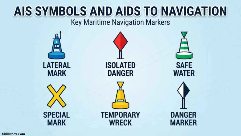
Some navigation aids can also use Automatic Identification System technology.
AIS allows information to be transmitted and displayed electronically. AIS can be associated with floating or fixed aids to navigation, including buoys, beacons, and lights.
NOAA explains that AIS aids can transmit information about the position and purpose of an aid, and chart displays can distinguish certain physical and virtual AIS aids.
Virtual AIS aids are especially important to understand because the charted aid may represent an electronically transmitted navigation aid rather than a physical buoy that you can see in the water.
IALA Maritime Buoyage System
The IALA Maritime Buoyage System provides internationally recognized principles for marking navigable waters.
IALA buoyage is divided into different regions, and the applicable region affects how certain lateral marks are interpreted.
For this reason, learning buoy colors and shapes without learning the applicable region can lead to confusion. NOAA’s U.S. Chart No. 1 provides information about the buoyage system relevant to U.S. charts.
When navigating outside familiar waters, confirm the local buoyage system before relying on memory.
Common Nautical Chart Symbols Beginners Should Learn First
You do not need to memorize every symbol immediately. Start with the symbols that are most relevant to everyday chart reading.
A useful beginner checklist includes:
- Soundings
- Depth contours
- Buoys
- Lateral marks
- Safe water marks
- Beacons
- Lighthouses
- Lights
- Wrecks
- Rocks
- Reefs
- Shoals
- Obstructions
- Anchorages
- Restricted areas
- Cables
- Pipelines
- Channels
- Compass information
- Common abbreviations
Once these categories become familiar, less common symbols become easier to understand because you already know how the chart organizes information.
Common Mistakes When Reading Nautical Chart Symbols
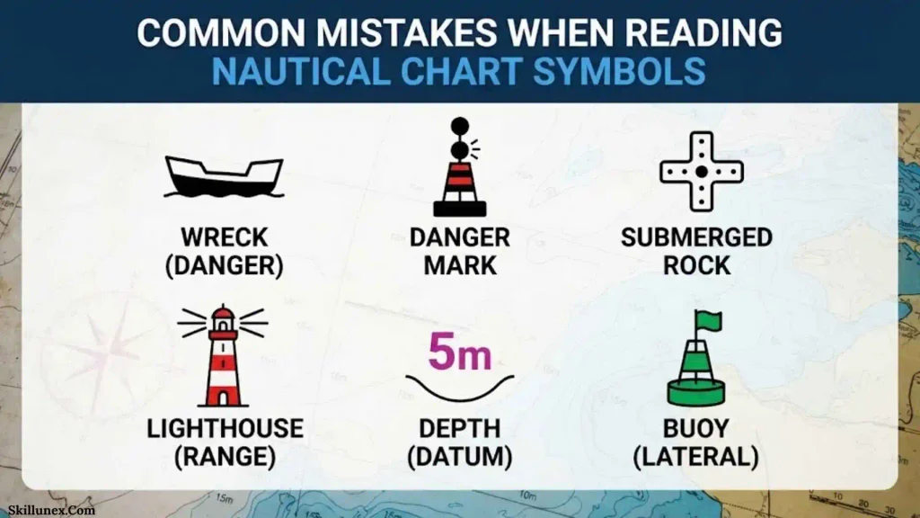
Assuming Every Symbol Is Universal
International charting standards create substantial consistency, but national chart products, buoyage regions, paper charts, and electronic systems can have differences.
Always use the applicable chart reference.
Ignoring The Chart Legend
A symbol that looks obvious may have a more specific technical meaning. The legend exists to prevent guesswork.
Looking Only At Depth Numbers
Depth numbers are important, but they are only one part of the chart. Rocks, wrecks, contours, restrictions, aids to navigation, tides, and other information also matter.
Treating An Anchorage Symbol As Permission
An anchorage symbol does not automatically override local rules or restrictions. Check the applicable regulations and chart information.
Using An Old Chart
Navigation information can change. NOAA notes that updates may include new shoals, wrecks, obstructions, navigation aids, and changing shorelines.
Assuming Electronic And Paper Symbols Are Identical
Electronic chart displays can portray information differently from paper charts. NOAA’s U.S. Chart No. 1 specifically covers both paper chart symbols and NOAA ENC portrayal on ECDIS.
How To Learn Nautical Chart Symbols Faster
The easiest way to learn nautical chart symbols is through repeated practical use rather than trying to memorize an entire symbol book in one sitting.
Start with a small group of common symbols. Find them on an actual chart and compare each symbol with its official definition. Then gradually add new categories.
A useful learning sequence is:
- Learn chart orientation and compass information.
- Learn soundings and depth contours.
- Learn common navigation aids.
- Learn wreck, rock, shoal, and obstruction symbols.
- Learn anchorages and restricted areas.
- Learn seabed abbreviations.
- Learn light characteristics.
- Learn less common specialized symbols.
- Practice comparing paper and electronic chart representations.
This approach allows you to understand how symbols work together rather than memorizing isolated shapes.
Where To Find An Official Nautical Chart Symbol Guide
For U.S. chart users, NOAA’s U.S. Chart No. 1 is a key reference. NOAA describes it as the symbol legend for U.S. nautical chart products and states that it contains more than 100 pages of information about nautical chart symbols. It covers paper chart symbols and the portrayal of NOAA ENC data on ECDIS.
For international charting standards, the International Hydrographic Organization maintains S-4 and associated publications, including INT 1, INT 2, and INT 3. IHO describes INT 1 as the publication covering symbols and abbreviations used on paper charts.
Frequently Asked Questions About Nautical Chart Symbols
What Are Nautical Chart Symbols Used For?
Nautical chart symbols are used to represent depths, hazards, navigation aids, seabed features, coastal structures, restricted areas, and other information needed to interpret a marine chart.
What Is U.S. Chart No. 1?
U.S. Chart No. 1 is an official reference that explains symbols, abbreviations, and terms used on U.S. nautical charts. NOAA states that it also covers the portrayal of NOAA electronic navigational chart data on ECDIS.
What Do Numbers On A Nautical Chart Mean?
Numbers in water areas commonly represent charted soundings or depths. Their meaning should be interpreted using the chart’s units, vertical datum, and surrounding chart information.
What Do Buoy Symbols Mean On A Nautical Chart?
Buoy symbols identify floating aids to navigation. Their colors, shapes, top marks, lights, and other characteristics help communicate their navigational purpose under the applicable buoyage system.
What Is The Difference Between A Buoy And A Beacon?
A buoy is normally a floating aid to navigation, while a beacon is a fixed aid. Both can mark channels, hazards, or other navigational locations.
What Does A Wreck Symbol Mean On A Nautical Chart?
A wreck symbol identifies a charted wreck or wreck-related feature. The surrounding information may indicate its depth or other characteristics relevant to navigation.
What Does An Anchor Symbol Mean On A Nautical Chart?
An anchor symbol can identify an anchorage or anchorage-related information, but it should not automatically be interpreted as permission to anchor anywhere in the surrounding area. NOAA specifically provides guidance on the meaning and limitations of anchorage symbols.
What Do Depth Contours Show?
Depth contours connect locations with similar charted depths and help show the shape and changes of the underwater terrain.
Are Nautical Chart Symbols The Same Worldwide?
Many chart symbols are based on international standards, but national charting authorities and buoyage regions can have differences. The IHO maintains international charting standards, while individual hydrographic offices publish applicable national chart information.
Are Electronic Chart Symbols The Same As Paper Chart Symbols?
Not always. Electronic chart systems can portray chart information differently from paper charts. NOAA’s U.S. Chart No. 1 provides information for both paper charts and NOAA ENC portrayal on ECDIS.
Why Is It Important To Use An Updated Nautical Chart?
Charted conditions and navigation information can change. NOAA explains that chart updates can include new shoals, wrecks, obstructions, navigation aids, and shoreline changes.
What Is INT 1?
INT 1 is an International Hydrographic Organization publication containing symbols, abbreviations, and terms used on paper charts prepared according to IHO chart specifications.
How Can Beginners Learn Nautical Chart Symbols?
Beginners can start with soundings, depth contours, buoys, lights, wrecks, rocks, obstructions, anchorages, and common abbreviations. Using an official chart legend while practicing with real charts is more reliable than memorizing symbols without context.
Conclusion
Nautical chart symbols turn a complex marine environment into a readable visual system. Soundings and depth contours show underwater depth, buoys and beacons provide navigation references, lights help identify aids, and symbols for wrecks, rocks, shoals, obstructions, cables, pipelines, anchorages, and restricted areas provide information that can be important when planning and conducting navigation. Learning these categories makes it much easier to understand what a nautical chart is communicating.
The most reliable way to interpret an unfamiliar symbol is to use the official reference for the chart you are reading. For U.S. charts, NOAA’s U.S. Chart No. 1 provides an extensive guide to symbols, abbreviations, and terms, while the IHO maintains international standards and publications such as INT 1. Always consider the chart’s legend, units, datum, buoyage region, notes, and update information instead of relying on memory alone.

Caleb Thornton
I’m Caleb Thornton, a researcher and content writer who loves exploring fascinating subjects and sharing what I learn with readers. My interests include natural places, lakes, symbols, culture, history, and the stories that make ordinary topics more meaningful.
When I write an article, I try to go beyond a basic answer. I look for useful facts, relevant context, and details that can help readers understand the subject more completely.
My purpose is simple: I want every article I contribute to provide genuine value, satisfy the reader’s curiosity, and make discovering new information enjoyable.
## Books by Caleb Thornton
* Symbols & Meanings: Exploring the Signs We See Every Day
* Lakes of the World: Nature, Beauty & Exploration